San Diego Trails

- Publisher: William Modesitt
- Genre: Navigation
- Released: 9 Mar, 2017
- Size: 579.9 MB
- Price: $2.99
 Click here to request a review of this app
- App Store Info
Description
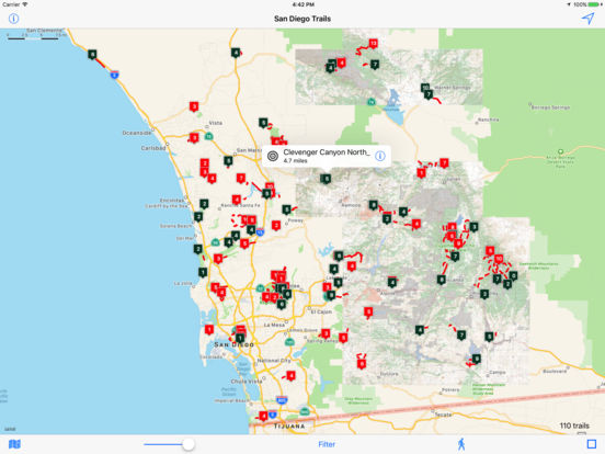
San Diego county is an ideal location for hiking and biking.The San Diego County Trails app contains over 100 trails within or near San Diego county. The app also contains TOPO maps of many area that may be out of cellular range, so you never have to worry about viewing the map or trail when there is no Internet connection.
Trail data is obtained from gypsies.com, hikingsdcounty.com and modernhiker.com. Trails range from a leisurely 1/2 mile nature trail to a energetic 14 mile hike up a mountain. More trails will be added in the future. Feel free to let us know which trails we should add.
With the app you can
- Filter the trails to display only trails less than or greater than a specific length, and if they allow bikes or are hiking only.
- Display the map in standard mode, satellite mode, or with Open Cycle Maps.
- List the trails in length, distance from you, or trail name.
For each trail, you can
- View your location on the trail as you hike or bike.
- Obtain weather info.
- View an elevation chart.
- Access a web site specific to the trail.
- View a Google map of a selected waypoint.
- View a Google route between the trail and your current location.
- Send the trail location to Apple Maps.
- View Flickr photos near the trail (if they exist).
For more info and screenshots, visit modesittsoftware.com/trails


